HEALTH, POVERTY, AND PLACE IN
ACCRA, GHANA
Click to view an interactive Flash map of Accra, Ghana.
ABOUT:
This project, through a detailed analysis of spatial disparities in health in Accra, Ghana, aims to provide a model for the interpretation of urban health inequalities in cities in poor countries. Using Accra in Ghana, we will generate methods that we hope will serve as templates for comparative analyses of other major cities in the developing world. The project will produce a geographical synopsis of the differentials in health and mortality within the urban area in a format immediately accessible to government and the development agencies tasked with the improvement of health overall and with the reduction of health inequalities; map the distribution of poverty in the city and assess its spatial association with selected health and mortality outcomes; using remote sensing and GIS technology, measure the association of adverse health and mortality outcomes with neighborhood ecology, including the association with spatial measures derived from observations of physical features and built structures visible from multi-spectral high spatial resolution satellite imagery; and assess the additional contribution of community-level variables including social organization and institutions to the production of inequalities in health and mortality, net of individual-level characteristics.
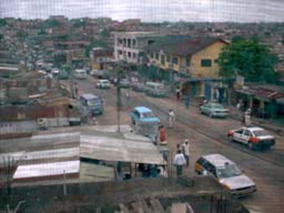
Street photo shot of Accra
Our research involves the following major steps: (1) apply new methods of defining urban neighborhoods across space and time using census and survey data and information from remotely sensed imagery; (2) validate data-derived neighborhood definitions, attributes, and boundaries with field assessments in a purposive sample of Accra neighborhoods; (3) assemble existing census-based, survey-based, and vital statistics-based measures of morbidity and mortality at the neighborhood level, based on the derived neighborhood definitions, as well as existing and updated imagery and geographic layers; (4) re-interview (in 2008 and 2009) the respondents to the 2003 Accra Women's Health Survey to generate new measures of neighborhood-level health outcomes and changes in those outcomes; (5) employ spatial analytic, multivariate and multi-level analyses to predict the inequalities in health outcomes between and within neighborhoods of Accra; (6) develop models that build on the WHS and DHS data in combination with the imagery to predict health outcomes by neighborhood; (7) apply the modeling algorithms to two key resources. The Demographic and Health Survey and remotely sensed imagerys to predict the variability (inequality) in neighborhood level health outcomes in Accra; and (8) employ the results locally in Accra for health policy and planning purposes, and use the results from relatively data-rich Accra to develop models that can subsequently be used to estimate the spatial variability in health in data-poorer cities in sub-Saharan Africa. Funded by the National Institute of Child Health and Human Development: Grant # 1 R01 HD054906-01.
Core Project Team:
PI - John R. Weeks
Co-PI - Allan Hill
Co-PI - Arthur Getis
Co-PI - Douglas A. Stow
Co-PI - David Rain
Co-PI - Ryan Engstrom
Post-Doc Researcher - Anna Carla Lopez
Research Specialist - Lloyd Coulter
Graduate Student Researchers:
Justin Stoler, Chris Lippitt, Magdalena Benza , Marta Jankowska, Sory Toure, Sean Taugher, Cindy Tsai, Madeline Tuller, and Milo Vejraska.
Previous Student Researchers:
Dr. Debbie Fugate, Sarah Hinton, Meredith Albert Gerhardt, Dean Daniels, Gregg Verutes, Chung-Rui Lee, and Jeanie Gaudette.
Publications:
Read more at: our publications
Interactive Map of Accra, Ghana
The Department of Geography at San Diego State University (in collaboration with the Harvard School of Public Health and George Washington University) acquired 70 tiles of high-resolution vector data for Accra, Ghana. These features were then overlaid with QuickBird imagery. By utilizing the most comprehensive roads network with hydrographic features and points of interest, Mr. Gregg Verutes created detailed maps of specific Enumeration Area (EA) boundaries. These polygons (analagous to US Census tracts) highlight the areas where fieldworkers still need to locate additional subjects. This Flash document (http://www.geointerest.frih.org/accra.swf) represents a streamlined version of the original printed field maps created to locate subjects. It aims to facilitate the efforts of fieldworkers in their search for the same subjects from the first round of the WHS.