APPLICATIONS OF REMOTE SENSING/GIS TO AN ANALYIS OF THE ARAB FERTILITY TRANSITION(AFT)
ABOUT:
The AFT project began as a pilot project (1998-2000) funded by the Andrew W. Mellon Foundation to test the use of remotely-sensed images, Geographic Information Systems (GIS), and spatial analysis to model the spatial and temporal variability in fertility in Egypt in both a rural setting (Menufia Governorate) and an urban setting (central Cairo). The results obtained from the pilot phase were sufficiently promising to extend the research to include a broader geographic coverage. The AFT was then supported by the National Science Foundation (2001-2004) and its geographic scope has been extended to other areas within Egypt, and also to urban and rural areas in Jordan. The project is administrated by the International Population Center, in the Department of Geography, San Diego State University
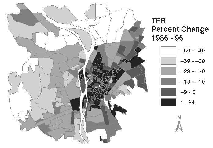
Fertility transition (1986-1996) in Cairo, Egypt
Project Team:
PI - John R. Weeks
Co-PI - Saad Gadalla
Co-PI - Allan Hill
Co-PI - Douglas A. Stow
Co-PI - Arthur Getis
Graduate Student Researchers:
Dr. Tarek Rashed, Dr. Debbie Fugate, Xiaoling Yang, Heather Davis, Jeffery Beyoghlow, and James Stanforth
Publications:
Read more at: our publications