Progress
2010 Surveys
From January to March of 2010, a survey of 268 households was completed in FNNR on demographics, livelihood, reforestation participation, resource use, land use, and environmental perceptions. In addition, 8 village leaders and 8 reserve personnel were interviewed. The surveys (in both English and Chinese) can be found here. Household / Village Leader / Reserve Personnel
Note: documents in Portable Document Format (PDF) require Adobe Acrobat Reader 5.0 or higher to view, download Adobe Acrobat Reader
Data Collection
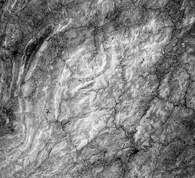
Landsat remote sensing imagery was used for the project due to its multi-date coverage of the area and accessibility. Since the imagery is at 30 meter resolution, changes in vegetation patterns such as illegal mining deforestation should be visible (Cavette 1999). Imagery from 1976 to 2009 was collected through download from Earth Explorer (Table 1). Each year was analyzed for viability based on image quality from registration to cloud cover. Cloud cover limited the use of imagery to 1976, 1993, 1999, 2000, 2002, 2003, and 2009. After initial viewing, preliminary normalized difference vegetation indices (NDVIs) were created. From viewing these NDVIs and running preliminary change detections, it was determined that there was no visible growing pattern of deforestation. This could be due to the length of time between images allowing for regrowth of the understory. Since there was no prevailing pattern, it was determined that the NDVI of the latest image and the change detection between the two most recent images would be most useful in identifying current deforestation for validation of the methodology. For this, the imagery from 2003 and 2009 was chosen.
Image Processing
The imagery was downloaded with at least Standard Terrain Correction (Level 1T) processing, which “provides systematic radiometric and geometric accuracy by incorporating ground control points while employing a Digital Elevation Model (DEM) for topographic accuracy” (http://edc.usgs.gov/products/satellite /tm.php). The images lined up with the reserve boundary shapefile provided by my advisor, Dr. An, but a lack of ancillary data for the area did not allow for more specific referencing. Since the images are mainly vegetation, with a lack of permanent structures, they were assessed for registration accuracy through geolinked viewer and layerstacking analysis of major feature (roads, rivers, etc…) coincidence. Since the images were compared with each other, a histogram match was also completed to minimize illumination differences between the two dates.
Vegetation Indices
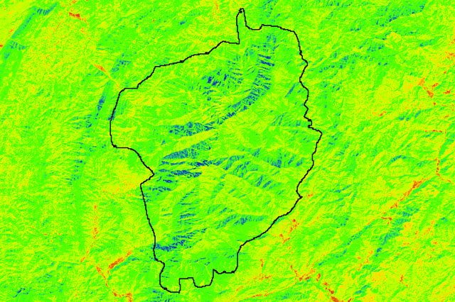
 The vegetation patterns in the subset study area images from 2003 and 2009 were classified using a normalized difference vegetation index (NDVI), which differentiates between vegetation, cleared land, and water (Limpitlaw, 2002). This index is further useful because it reduces terrain illumination effects, an issue in the mountainous forest reserve. There were still some illumination effects in the 2009 NDVI since the imagery was acquired in January at a lower angle. To address this, a density slice was performed on the 2009 NDVI to make the distinction between the low NDVI values more visible. For the image comparison, image differencing was used, which shows the increases (growth) or decreases (possible deforestation) in NDVI values from 2003 to 2009. A density slice was also performed on the resulting difference image to show change and highlight low values from vegetation loss.
Deforestation Analysis
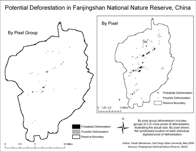
Through analysis of the NDVIs and the time comparisons, the following areas of potential deforestation with the forest reserve were derived.
GPS Collection
Over the course of field work from May to June of 2009, over 50 elevation and ground control points were collected to improve the accuracy of the imagery analysis. Upon return to SDSU, the ground control points were determined to line up with the imagery, showing the accuracy of the registration. Further points along the trails were collected and will be used to plan the fall field work and logistics to visit the potentially deforested sites for ground truthing.
Interviews
During the first field work trip, approximately 40 interviews were completed with locals villagers on the edge of the forest reserve. The interview questions focused on conservation awareness, support, and concerns.